Property Type:
Land
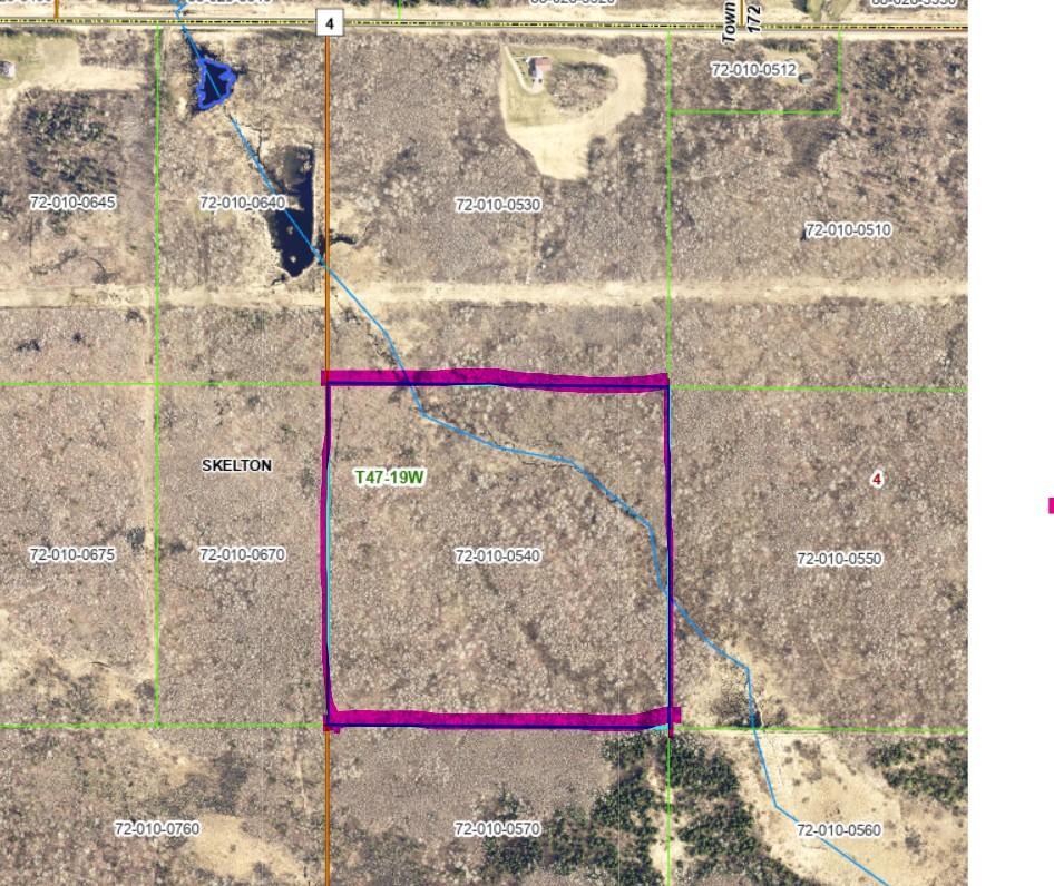
Lot Size (sq. ft.):
1,742,400
Status:
Active
Current Price:
$45,000
List Date:
5/01/2026
Last Modified:
5/01/2026
Overview
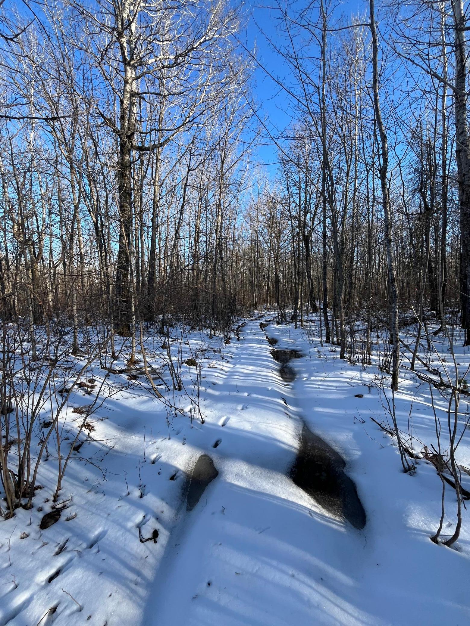
Description
40-acre wooded parcel located northwest of Barnum, MN. This property is ideal for recreational activities. The south side of the parcel borders tax-forfeited land. Property has been recently surveyed.
Last Updated: May - 01 - 2026
The data relating to real estate for sale on this web site comes in part from the Broker
Reciprocity SM Program of the Regional Multiple Listing Service of Minnesota, Inc. The information provided is deemed reliable but not guaranteed. Properties subject to prior sale, change or withdrawal.
©2024 Regional Multiple Listing Service of Minnesota, Inc All rights reserved.